Tag ★★★★

Yamanami highway

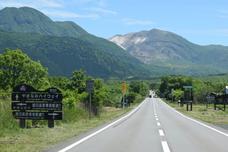
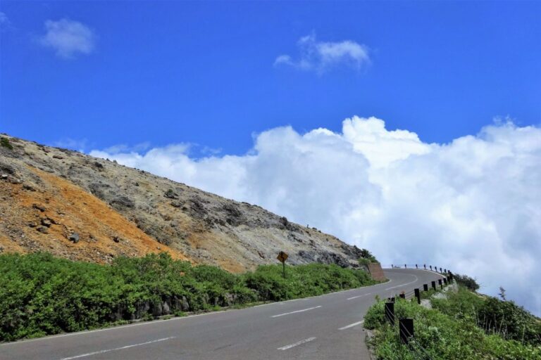
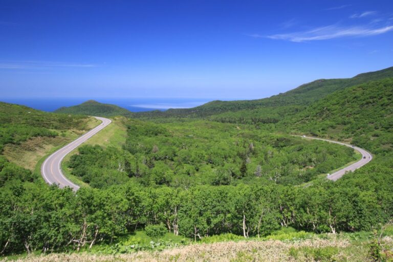
The Yamanami Highway is a scenic 58 km mountain road that connects Beppu City in Ōita Prefecture with Aso City in Kumamoto Prefecture. Officially known as Prefectural Route 11 (Beppu–Ichinomiya Line), it is famous among riders for its breathtaking views…

Aso Milk Road

Aso Milk Road is a scenic road that runs along the outer rim of Mt. Aso in Kumamoto Prefecture.The name “Milk Road” comes from the many farms and pastures nearby.You can enjoy wide open grasslands, cows grazing, and beautiful views…

Aso Panorama Line

The Aso Panorama Line is a scenic drive in Kumamoto Prefecture, running around Mount Aso.It includes three main roads: the North, South, and West approach roads.These routes take you through wide grasslands and up toward the active crater of Mt.…

Bandai-Azuma Skyline

The Bandai-Azuma Skyline is a scenic mountain road in Fukushima Prefecture, stretching about 29 km from Takayu Onsen to Jododaira. Reaching an elevation of 1,622 meters, it’s selected as one of the Top 100 Roads in Japan. This dramatic route…

Route273 (Nukabira National Highway)

Nukabira Road (National Route 273) is a scenic mountain highway in Hokkaido, stretching about 120 km from Kamishihoro Town through the Daisetsuzan Mountains toward the Kitami area. The section from Kamishihoro to Lake Nukabira, Mikuni Pass, and Sounkyo offers stunning…

Hachimantai Aspite Line

The Hachimantai Aspite Line is a scenic mountain road stretching about 27 km, connecting Hachimantai City in Iwate Prefecture with Kazuno City in Akita Prefecture.Named after an “aspite” volcano (a gently sloping volcanic shape), the route winds along soft ridgelines,…

Zao Echo Line

The Zao Echo Line is a scenic mountain road that stretches about 26 kilometers, connecting Zao Town in Miyagi Prefecture to Kaminoyama in Yamagata Prefecture. This route crosses the Zao mountain range at an elevation of around 1,600 meters, offering…

Chokai Blue Line

The Chokai Blue Line is a scenic mountain road connecting Nikaho City in Akita Prefecture with Yuza Town in Yamagata Prefecture. Stretching about 34 km, it climbs to the Hokodate Observatory at around 1,100 meters above sea level, offering stunning…

Hokkaido Route 106 (Sarobetsu Plain Route)

Hokkaido Prefectural Route 106 (Wakkanai–Teshio Line) runs along the Sea of Japan coast, connecting Wakkanai City to Teshio Town over a distance of about 68 km.The most scenic section is the stretch between Wakkanai and Horonobe, known as the Sarobetsu…

Shiretoko Pass Road

The Shiretoko Crossing Road (National Route 334) is the only national highway crossing the Shiretoko Peninsula in Hokkaido. It runs about 23.8 km between Utoro (Shari Town) and Rausu Town. This mountain route offers a dynamic ride through the untouched…