Tag 10-19km

Haruna Mountain Road

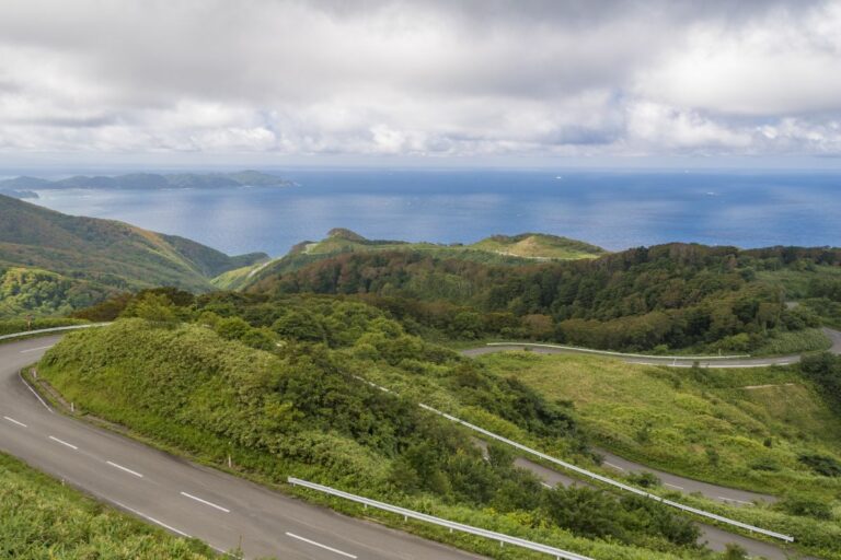
Route Overview Haruna Mountain Road is a scenic route in Gunma Prefecture that connects Takasaki City to the Haruna Lake and Mount Haruna area. It mainly follows Prefectural Route 33 (Shibukawa-Matsuida Line) and Route 28 (Takasaki-Higashiagatsuma Line), climbing to about…

Myogi Mountain Road

Route Overview Myogi Mountain Road, officially Gunma Prefectural Route 196, is a scenic mountain route about 10 km long that runs along the southern base of Mount Myogi. Known as one of Japan’s three most dramatic rocky landscapes, the road…

Kujukuri Toll Road

Route Overview The Kujukuri Toll Road is a scenic seaside route running about 10 km along Kujukuri Beach in eastern Chiba Prefecture. Also known as the Naminori Doro (“Surfing Road”), it offers a refreshing ride with views of the Pacific…

Okutama Road

Route Overview The Okutama Loop Road (also known as Okutama Road) is a scenic mountain route about 20 km long, connecting Okutama Town and Hinohara Village in western Tokyo. It consists of parts of Tokyo Route 206 and Route 33.…

Hakone Ashinoko Skyline

Route Overview The Hakone Ashinoko Skyline is a scenic toll road about 10.7 km long, connecting Kojiri in Hakone, Kanagawa Prefecture, to Mikuni Pass in Susono City, Shizuoka Prefecture. Running along a mountain ridge at around 1,000 meters in elevation,…

Yahiko Mountain Skyline

Route Overview The Yahiko Skyline is a scenic mountain road in Niigata Prefecture, stretching about 13.7 km and connecting Yahiko Village with the Teradomari coastal area. It climbs up Mount Yahiko (634 meters above sea level), offering panoramic views of…

Osado Skyline

Route Overview The Ōsado Skyline is a scenic mountain drive crossing Sado Island in Niigata Prefecture, stretching about 30 km between Ryōtsu and Aikawa. Running along ridgelines around 900 meters high, it offers breathtaking views of the Sea of Japan,…

Uonuma Skyline

Route Overview The Uonuma Skyline is a scenic mountain road stretching about 19 km through Niigata Prefecture, connecting Minamiuonuma City and Tokamachi City. It is part of Niigata Prefectural Route 560. Running along a ridge at around 700–800 meters in…

Tatsudomari Line

The Tatsudomari Line is a scenic 20 km mountain and coastal road connecting Cape Tappi (Tappizaki) in Sotogahama Town with Kodomari in Nakadomari Town, in northern Aomori Prefecture. It is part of National Route 339, and is also selected as…

Yamadaira Plateau, Mt. Hakkoda

Route Overview The Hakkōda–Yamashirodaira Route winds through the scenic Hakkōda Mountains in Aomori Prefecture. It can be accessed via National Route 103 or Prefectural Route 40 (also known as the Hakkōda Gold Line). Located at around 1,000 meters in elevation,…