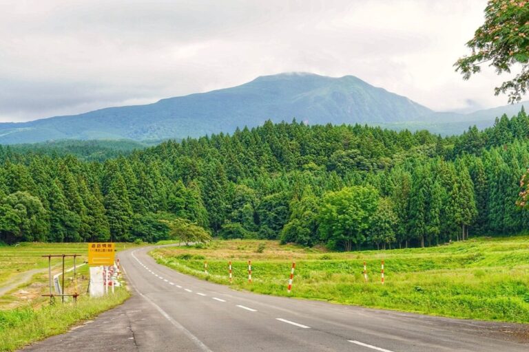
Category Touring Routes

Zao Echo Line

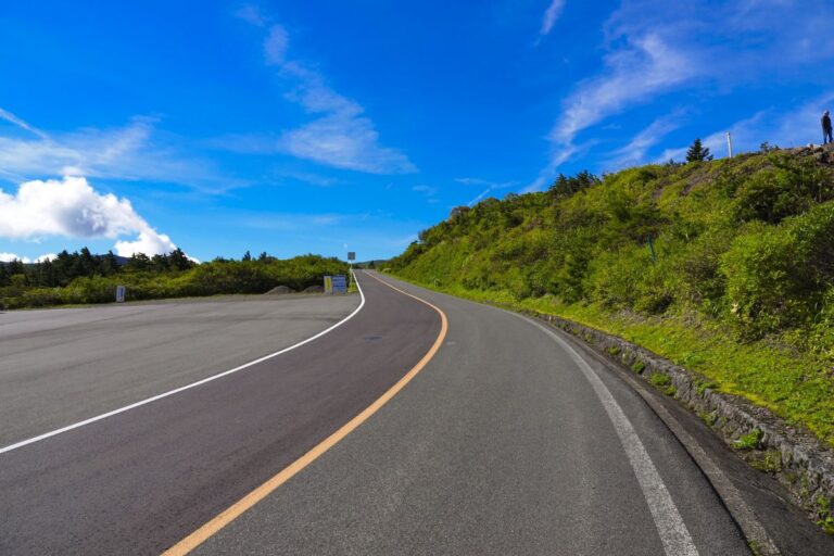
The Zao Echo Line is a scenic mountain road that stretches about 26 kilometers, connecting Zao Town in Miyagi Prefecture to Kaminoyama in Yamagata Prefecture. This route crosses the Zao mountain range at an elevation of around 1,600 meters, offering…

Kampu Panorama Line

Route Overview The Kanpuzan Panorama Line is a scenic driving and touring route that circles the summit of Mount Kanpuzan in Oga City, Akita Prefecture. With an elevation of 355 meters, the road offers 360-degree panoramic views. On clear days,…

Chokai Blue Line

The Chokai Blue Line is a scenic mountain road connecting Nikaho City in Akita Prefecture with Yuza Town in Yamagata Prefecture. Stretching about 34 km, it climbs to the Hokodate Observatory at around 1,100 meters above sea level, offering stunning…

Gassan Hanagasa Line

Route Overview The Gassan Hanagasa Line is a scenic mountain road about 17 km long, connecting Shizu Onsen in Nishikawa Town to the 8th Station of Mount Gassan. Officially designated as Yamagata Prefectural Route 114, the road is named after…

Mie pref Route 128 (Pearl Road)

Route Overview Pearl Road (Prefectural Route 128) is a scenic road that connects Toba City and Shima City in Mie Prefecture. It is about 23 km long and runs along the beautiful coastline of the Ise-Shima area. The name “Pearl…

Hokkaido Route 106 (Sarobetsu Plain Route)

Hokkaido Prefectural Route 106 (Wakkanai–Teshio Line) runs along the Sea of Japan coast, connecting Wakkanai City to Teshio Town over a distance of about 68 km.The most scenic section is the stretch between Wakkanai and Horonobe, known as the Sarobetsu…

Hokkaido pref route 950 (Notsuke Peninsula)

Route Overview Hokkaido’s Route 950 runs along the Notsuke Peninsula in eastern Hokkaido. This approximately 18 km stretch of straight road crosses one of Japan’s narrowest peninsulas. With the sea and wetlands flanking both sides, riding here feels like you’re…

Soya National Highway

National Route 238, also known as the Soya National Highway, runs along the Okhotsk Sea coast from Wakkanai City in northern Hokkaido, passing Cape Soya, and continuing southeast. The section between Wakkanai and Cape Soya is especially famous among riders…

Shiretoko Pass Road

The Shiretoko Crossing Road (National Route 334) is the only national highway crossing the Shiretoko Peninsula in Hokkaido. It runs about 23.8 km between Utoro (Shari Town) and Rausu Town. This mountain route offers a dynamic ride through the untouched…

Okubiwako parkway

Route Overview Located in Nagahama City, Shiga Prefecture, the Oku-Biwako Parkway is an approximately 18.8 km one-way touring route. This scenic road runs along the northern tip of Lake Biwa, offering stunning lake views throughout. It’s known for cherry blossoms…